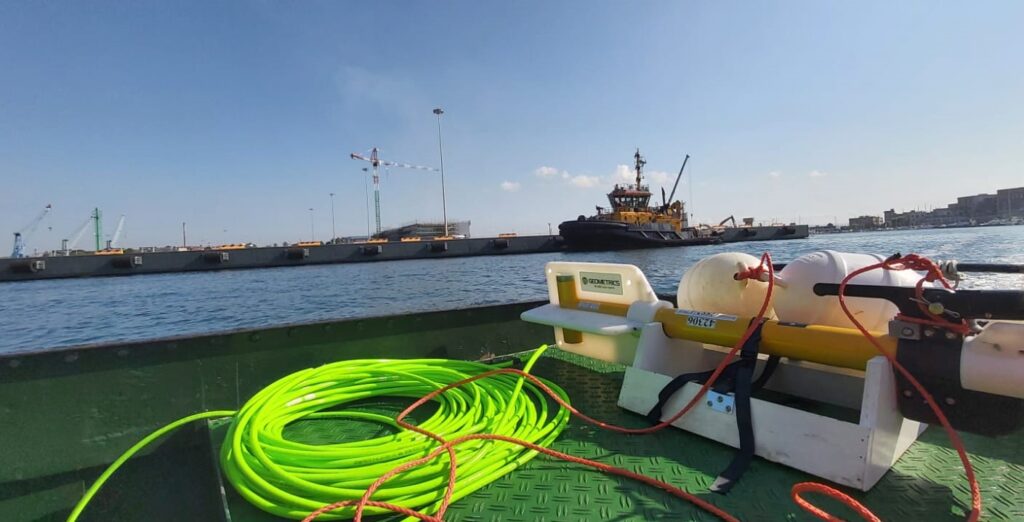
Using advanced, high-technology equipment, we conduct bathymetric surveys using single-beam and multibeam systems to define the bathymetric and morphological characteristics of the seabed, including the use of vibrocorer systems.
We also carry out surveys using Side Scan Sonar (SSS) to obtain an accurate plan-view representation of seabed morphology, including the size and shape of any objects detected.
In addition, we perform marine magnetometric surveys to measure the Earth’s magnetic field and identify any variations and ferromagnetic anomalies that may indicate the presence of buried or submerged metallic objects.
Bathymetric surveys are carried out whenever it is necessary to accurately determine the bathymetric profile and depth variations of the seabed. They are therefore essential prior to the construction of marine and river works and, for existing structures, are indispensable for continuously monitoring water depths and dredging volumes.
Bathymetric surveys also play a fundamental role in monitoring the evolution of beaches and coastal areas, particularly for quantifying erosion processes and assessing the effects of beach nourishment and coastal replenishment projects.
The range of surveys that can be performed extends from basic Single Beam echo sounder surveys, using appropriately spaced transects, to highly detailed surveys conducted with a Multi Beam echo sounder. The latter enables each portion of the surveyed area to be sampled with dozens of measurement points per square metre, providing millimetre-level accuracy.
Morphological surveys are conducted to determine the morphology of the seabed, investigate its nature and composition, and assess the distribution of sediments, rocky outcrops and/or Posidonia oceanica. They are also used to locate objects on the seabed and within the immediate sub-bottom, as well as to monitor the position, burial status and condition of underwater structures and installations.
Data are acquired using Side Scan Sonar (SSS), a side-looking sonar system that produces large-scale images of the seabed similar to aerial photographs. It provides acoustic imagery of the seabed, recording highly detailed, distortion-free and georeferenced digital images, as the system is integrated with the navigation software.
The Side Scan Sonar is undoubtedly one of the primary tools for studying seabed morphology and biocenotic mapping. It is used to survey extensive seabed areas and can also be employed to identify the presence of exposed archaeological artefacts or remains.
Depending on the required resolution and the thickness of the sub-bottom to be investigated, the most commonly used instrument is the Sub-Bottom Profiler (SBP).
When an acoustic signal reaches the seabed, part of the acoustic energy penetrates the seabed sediments and is reflected when it encounters a physical boundary between layers of materials with different densities. The Sub-Bottom Profiler detects changes in acoustic impedance associated with the physical characteristics of different sediment layers. This makes it possible, even in very shallow waters, to reconstruct sedimentation processes with a high degree of accuracy, identify buried objects, and determine the characteristics and relationships between different sedimentary layers.
The Sub-Bottom Profiler (SBP) consists of an onboard unit for data acquisition, control and recording, together with a towed underwater transducer (the so-called “towfish”). While being towed underwater along predefined survey lines, the towfish emits acoustic energy pulses at regular time intervals.
The system makes it possible to determine the stratigraphy and geology of the sub-bottom, including, for example, the presence of buried geological structures, areas affected by landslides, subsurface gas seeps, and sedimentary layers with high gas concentrations. It can also detect objects buried beneath the seabed and monitor the burial status and condition of buried underwater structures and installations.
Electromagnetic surveys are carried out using an electromagnetic magnetometer. The methodology is based on measuring spatial variations in the Earth’s magnetic field caused by the presence of bodies in the subsoil with different magnetic properties. Marine magnetometric surveys are performed using high-resolution magnetometers capable of detecting even weak magnetic anomalies.
This type of geophysical survey is widely used by CESUB for the detection and investigation of unexploded ordnance (UXO) and explosive remnants of war (ERW). Electromagnetic methods provide information on the distribution of electrical conductivity in the subsoil and on the presence of buried metallic materials.
Marine magnetometric surveys can be used for the following applications:
Location and delineation of buried metallic objects;
Detection of iron pipelines, cavities and bodies containing ferrous materials;